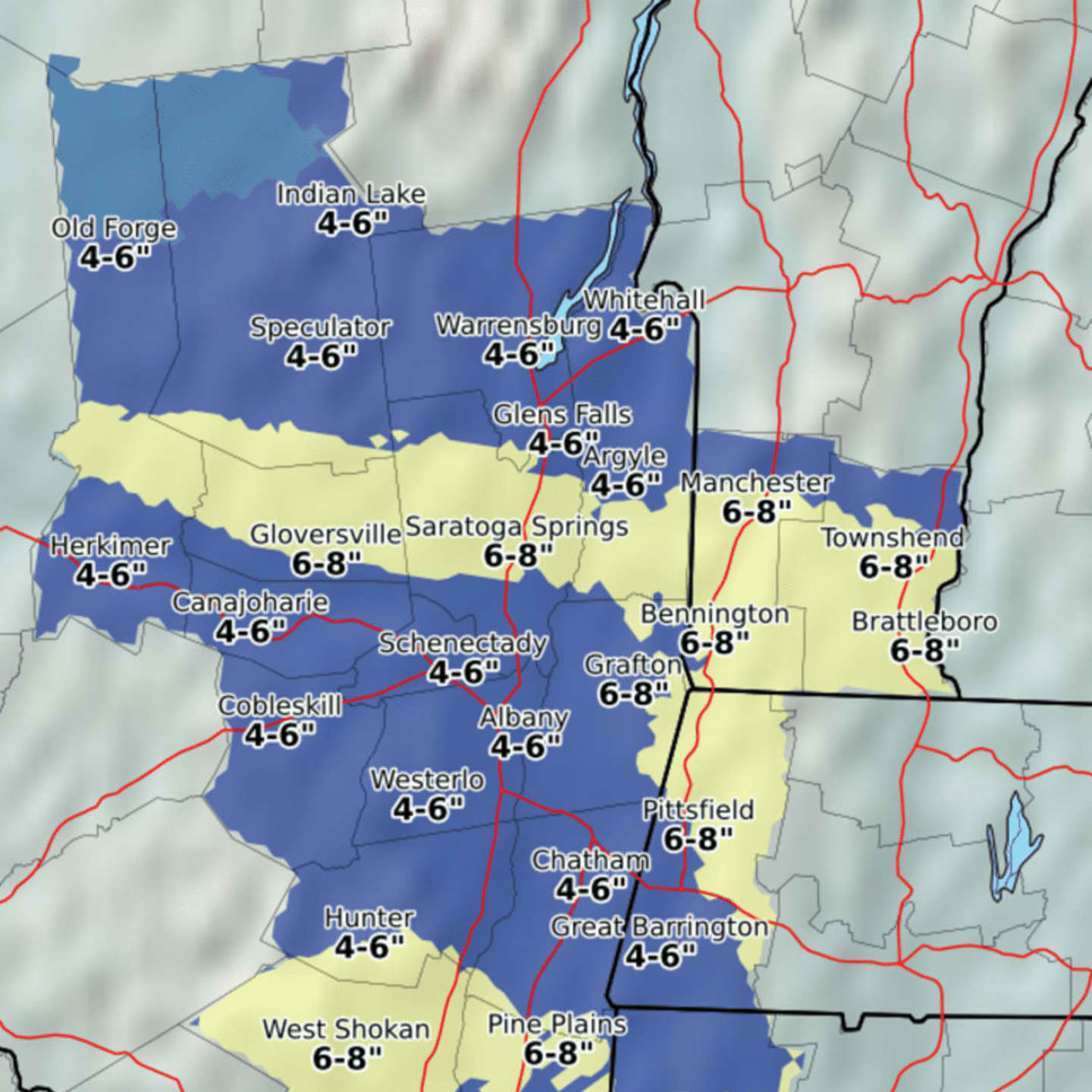
According to the National Weather Service, areas farthest north in Dutchess are expected to get 6-8 inches of accumulation A total of between 4 and 6 inches is projected for Poughkeepsie. (See image above.)
A Winter Weather Advisory is in effect from 1 a.m. to 1 p.m. Saturday. The advisory states that periods of snow will cause travel difficulties and that residents should be prepared for snow-covered roads and limited visibilities and use caution while driving.
Snow should begin falling sometime after 1 a.m. Saturday continuing through much of the morning before turning to rain and perhaps a period of sleet early Saturday afternoon.
After snowfall winds down around noon Saturday, there is a chance of rain and sleet between 1 p.m. and 4 p.m. Saturday. Rain is likely after 4 p.m., according to the National Weather Service.
Temperatures will increase from the teens and low 20s on Friday to near freezing Friday night and into the mid to upper 30s during the day Saturday.
Rain will continue on and off through 1 p.m. Sunday, followed by a chance of showers. Sunday's high temperature will soar to around 50 degrees.
The outlook for Monday calls for mostly sunny skies, but cold, with a high struggling to hit 30 degrees.
Please be sure to share this story by clicking on the Facebook icon below.
Click here to follow Daily Voice Northwest Dutchess and receive free news updates.