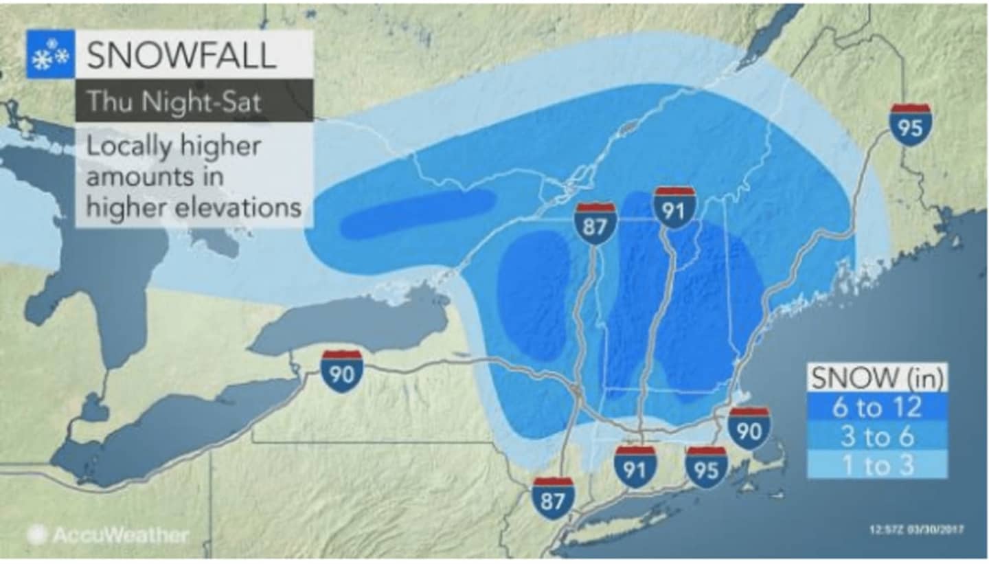

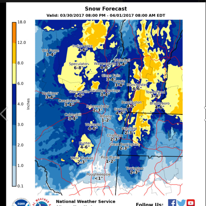
While areas near and south of Poughkeepsie likely will see mainly rain overnight into Friday morning, areas north have a threat for wet/dense snow, sleet and freezing rain, according to the latest projections by the National Weather Service.
Northernmost Dutchess, especially areas farther east, could see 2 inches of accumulation.
Rain is expected to arrive in the area after 9 p.m. Thursday, mixing with snow just before dawn.
The mix of sleet and rain will be followed by all rain after around noon as the daytime high reaches 37 degrees.
The next round of the wintry weather will arrive Friday night with rain mixing with sleet. Sleet will likely mix with snow showers before 8 a.m. Saturday, followed by a chance of rain and snow showers until 11 a.m.
The precipitation will taper off by around midday and Saturday's high temperature will be in the low-40s.
Sunday will be mostly sunny with a high around 50.
Be sure to share this post by clicking on the Facebook image below.
Check back to Daily Voice for updates.
Click here to follow Daily Voice Northwest Dutchess and receive free news updates.