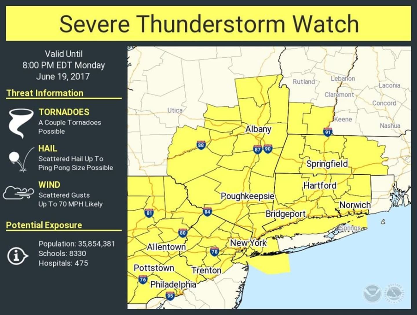


A line of heavy rain and potentially severe thunderstorms expected to move through the Hudson Valley Monday afternoon into the evening has resulted in a severe thunderstorm watch being issued by the National Weather Service.
The thunderstorm watch will be in effect through 8 p.m. Monday. It is possible the watch will be upgraded to a warning in parts of the area.
A Flash Flood Watch remains in effect for the entire area until 4 a.m. Tuesday.
Numerous showers and thunderstorms are expected to develop across the area from Monday afternoon into tonight ahead of a slow moving cold front, the weather service said.
Multiple rounds of thunderstorms have the potential to move across the same area, leading to flash flooding.
Rainfall totals of 1 to 2 inches are expected across the watch area, with locally higher amounts possible.
Original report:
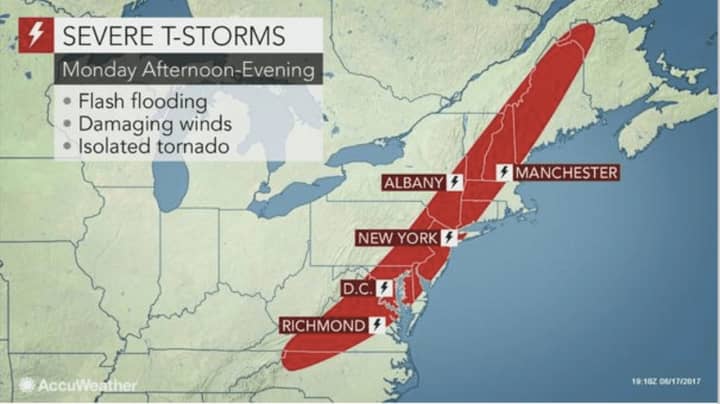
Hot, humid air that has settled in the area will contribute to conditions that could result in severe thunderstorms with flooding, heavy downpours, damaging winds, frequent lightning and a possible tornado on Monday as a cold front moves in from the west.
Breaks of sun during the day will heighten the chance for severe storm later in the day by destabilizing the atmosphere.
A Flash Flood Watch is in effect for the entire Hudson Valley from noon Monday until 4 a.m. Tuesday.
A Flash Flood Watch means that conditions may develop that lead to flash flooding., according to the National Weather Service, which warns that flash flooding is a very dangerous situation and residents should monitor later forecasts and be prepared to take action should the flash flood watch be upgraded to a flash flood warning.
Monday will be a mostly cloudy day with a high temp in the low-80s. Showers and thunderstorms are likely mainly after noon, with the severe storms possible after 1 p.m. as a slow-moving cold front arrives. The highest likelihood for severe storms is in the early evening.
Rainfall totals of 1 to 2 inches are expected across the area on Monday, with locally higher amounts, especially in any training thunderstorms.
More showers and storms are likely Monday night into Tuesday before clouds give way to mostly sunny skies with a high again in the low-80s.
Check back to Daily Voice for updates.
Click here to follow Daily Voice Northwest Dutchess and receive free news updates.