SHARE

Blizzard Warning Now In Effect For Dutchess

DUTCHESS COUNTY, N.Y. -- A significant westward shift in the major Nor’easter due to arrive in the area late Monday night has resulted in another increase in snowfall projections for Dutchess.

The Blizzard Warning for Dutchess, which went into effect late Monday afternoon, is from midnight Tuesday to midnight Wednesday.

The Blizzard Warning for Dutchess, which went into effect late Monday afternoon, is from midnight Tuesday to midnight Wednesday.

Photo Credit: National Weather Service
A look at the latest snowfall projections for Dutchess.

A look at the latest snowfall projections for Dutchess.

Photo Credit: National Weather Service
Snowfall projections for the entire region.

Snowfall projections for the entire region.

Photo Credit: AccuWeather.com
Blizzard Warnings are in effect for areas farther south and to the east.

Blizzard Warnings are in effect for areas farther south and to the east.

Photo Credit: AccuWeather.com

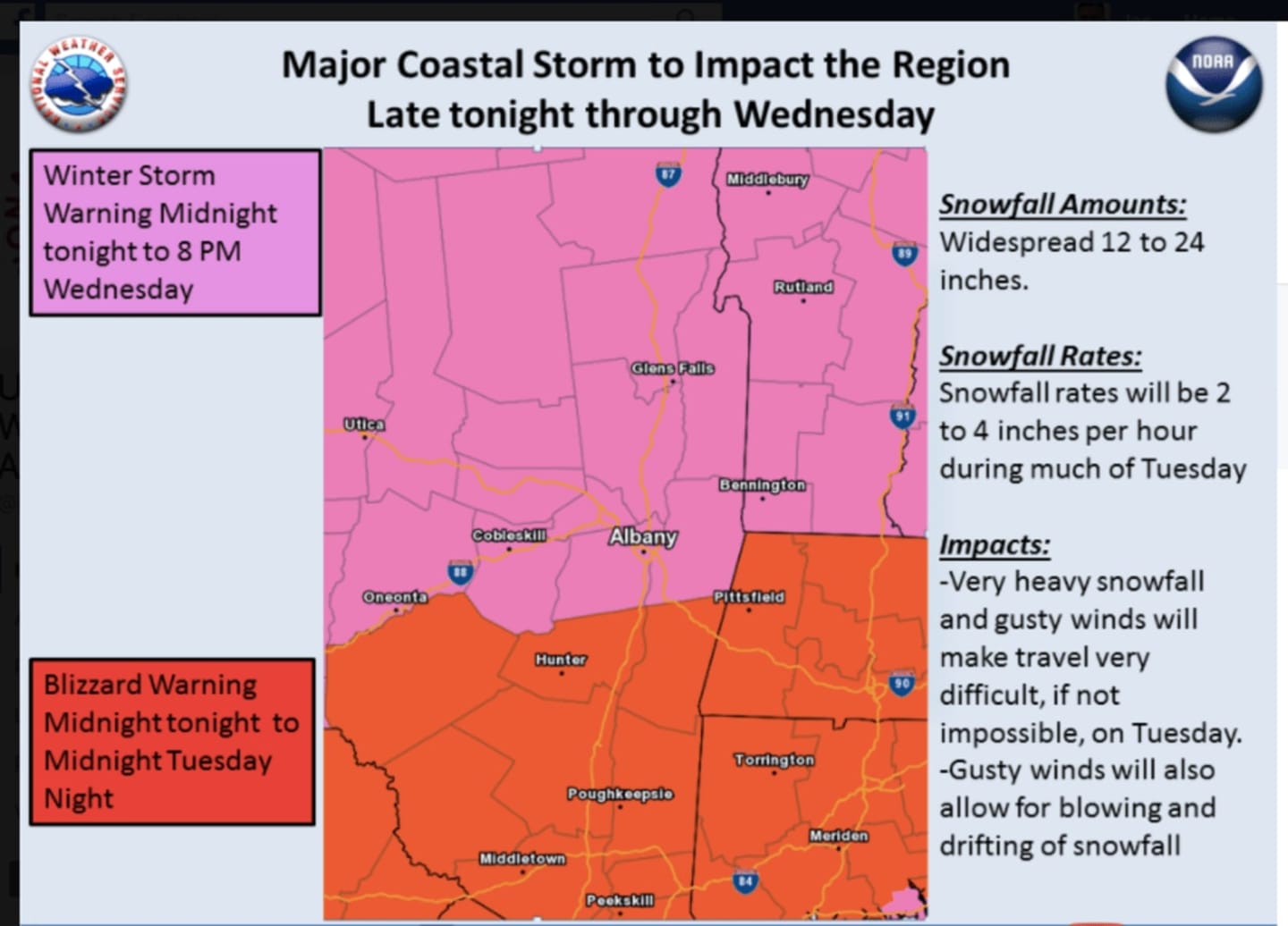
A Blizzard Warning was issued for Dutchess late Monday afternoon. It will be in effect from midnight Tuesday to midnight Wednesday.

A Winter Storm Warning is in effect for Dutchess from midnight Tuesday to 8 p.m. Wednesday. 

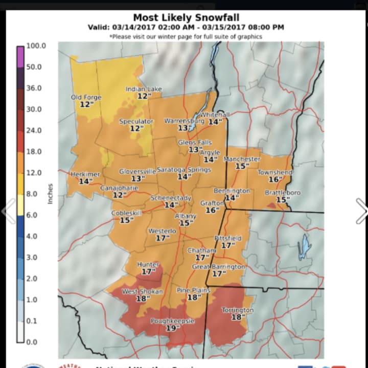
In addition to possible blizzard-like conditions, parts of Dutchess could see up to 19 inches of snowfall accumulation. (See chart above.)

There is the potential for falling and/or blowing snow with strong winds and extremely poor visibilities.

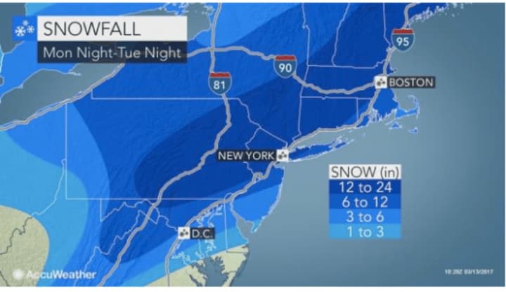
The major Nor'easter, expected to arrive overnight Monday into Tuesday, will bring with it heavy snow and gusty winds that could lead to power outages. This can lead to whiteout conditions and make travel very dangerous.

Be sure to check back to Daily Voice for updates on the timing and track of the Nor’easter and share this story on Facebook by clicking on the Facebook icon below.

to follow Daily Voice Northwest Dutchess and receive free news updates.

SCROLL TO NEXT ARTICLE